By Renato R. Colucci
Weather Trend Week n. 50 - 13-19 December 2021
The dismantling of the Rossby wave as supposed last week has actually happened and now the situation over Europe tends to reorganize rapidly from the synoptic point of view. In the coming days the embryo of what will become a powerful Blocking High with a diameter of almost 4000 km, on the way to dominate the European atmospheric dynamics in the coming weeks, will start to take shape. NAO index temporarily rising but simulations see it again falling in the second half of December. Let's see what will be the possible implications.
SYNOPTIC
We analyze the probable synoptic evolution related to the week 50 from Monday 13 to Sunday 19 December 2021, using the two main weather and climate models freely available on the web: the European model ECMWF, the American GFS.
The two main global weather models are in perfect agreement regarding the synoptic evolution of the coming week. This aspect raises the potential to predict how the coming week will evolve in detail.
Both models agree to see the emergence of a powerful anticyclone block with geopotential values rapidly strengthening and destined to grow. The 500 hPa geopotential height, in fact, will reach almost 5900 m. This is the most evident novelty, responsible for blocking the atmospheric flow directed not only to the Alps and the Mediterranean, but also those directed to northern Europe.

The predominant figure for the coming week will be a powerful dynamic anticyclone at all altitudes centered over northern Europe
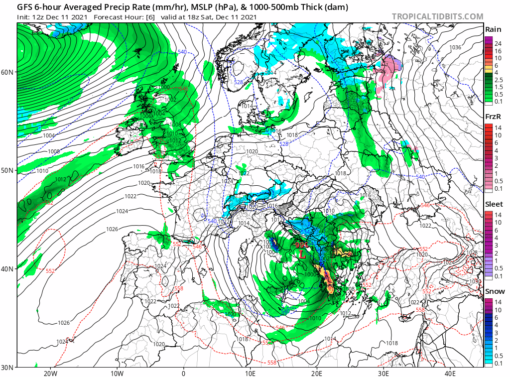
The low pressure system that in these hours is bringing rainfall and snowfall at low elevations in central and southern Italy, in the coming days will tend to move rapidly towards Albania and Greece, where it will tend to fill gradually. This configuration will give way to an anticyclonic promontory that from North Africa will push rapidly towards Central Europe on Monday.
In this first phase, both the European model ECMWF and the American model GFS are very much in agreement in seeing the same evolution of this high pressure that will tend to strengthen quickly moving northwest and positioning itself with its maximum between the British Isles, the low countries and northern France. The axis of the anticyclonic area will be more or less directed from west-southwest to east-northeast.

The almost perfect agreement between the European and American weather model regarding the positioning of the blocking anticyclone over Northern Europe
Once established in that position, the anticyclone appears to gradually strengthen and does not appear to have any intention of moving its range until all of next weekend.
Basically, a mighty anticyclonic cell with a diameter of about 4000 km will isolate itself in an abnormally northern position inflated by a deep but thin jet stream wave line that, with winds between 300 and 350 km/h at a geopotential altitude of 250 hPa (about 11 km), will settle south of Greenland. In the animation below from the global model GFS, you can see what has just been illustrated.
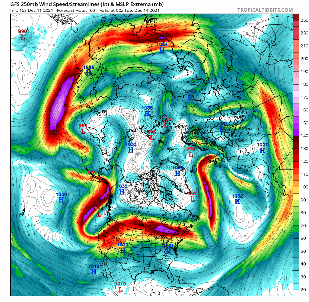
Winds at 250 hPa and synoptics of ground extremes according to the GFS model between December 14 and 18. Note the powerful circular anticyclonic area forming over the British Isles.
PRECIPITATION
The configuration just described makes practically zero the possibility of seeing precipitation over the macro region Alpeadria during the next week.
Expanding the view outside our geographical borders, such a powerful anticyclonic dominance will inhibit precipitation over most of Europe with the exception of far northern Europe and, only in the first part of the week, the central southern Balkans and Greece.
In the following animation from the GFS model the synthesis of what has just been described
The establishment of the mighty high pressure area will inhibit precipitation over most of Europe. Animation GFS 12-19 december
TEMPERATURE
The synoptic configuration discussed above is not prone to produce cold outbreaks in our area, but rather mild temperatures, especially at high altitudes and during the day. As early as Monday, temperatures will rise above zero until well over 2000 m above sea level, and between Tuesday and Thursday the zero temperature is expected to rise up to almost 3000 m.
This situation will surely lead to the triggering of thermal inversions in the alpine valleys and, during the night, also in the lowland areas. This aspect will increase the daily temperature range with temperature differences between day and night of more than 10°C. This aspect will be particularly felt in the plain and in the hilly areas of Friuli Venezia Giulia.
On the plains for the entire week the minimum temperatures will be a few degrees below zero at night, then rise to around 8-10 ° C during the day. Fog and low clouds will be absent on the plains and coasts of Friuli Venezia Giulia. Fog and low clouds will be frequent in Carinthia and Slovenia, leading to persistent cold inversion conditions.

Ground (left) and 850 hPa (right) temperature anomalies according to the GFS model centered on Wednesday, December 15.
The positive temperature anomaly will gradually spread across the European continent, and in particular over the Netherlands, Germany and Scandinavia. In the image above, forecasted for Wednesday 15, the temperature anomaly at 2 meters above the ground.
In the following image, instead, the temperature anomaly at 850 hPa (1400 m) forecast for Saturday by GFS and ECMWF models. It is highly possible, given the synoptic configuration, that over southern Scandinavia we can touch positive anomalies of +14/+16 °C.

The temperature anomaly predicted in altitude by the ECMWF model for Saturday, December 18. Over southern Scandinavia the values exceed +15°C anomaly compared to normal values.
SNOW
No chance of snowfall in the Alps for the entire week. The only snowfall will occur over the south-central Balkans in the early part of the week. They will be weak and fading due to stau conditions (orographic lift) on Monday, north of the Karavanke.
In the image below the snow totals expected until Tuesday, December 14.

Map of the total accumulations of snow on the ground between Sunday 12 and Tuesday 14 December, according to the model GFS
NAO INDEX
The synoptic configuration described above is confirmed by the rapid rise of the NAO index predicted for the beginning of the second decade of December. The NAO index (North Atlantic Oscillation) is given by the difference in pressure between the Azores anticyclone, normally positioned on the upper Atlantic, and the Icelandic low.
Established an average value of reference, the deviations from the normal situation that occur over time are detected. Due to the chaotic nature of the atmospheric system, seasonal climate models are not able to predict this index with accuracy. Meteorological models, on the other hand, are able to correctly show its dynamics up to a maximum of 15 days.
In the image below provided by the Climate Prediction Center del NOAA, the NAO index seems to return to slightly negative values in the second part of the month. This circumstance suggests that the phase of high blocking just described could evolve rapidly and that in the week of Christmas there could be a new reversal of the synoptic, at least from the thermal point of view.

NAO index, source Climate Prediction Center del NOAA
A trend line needs confirmations that we invite to deepen always following the updates of the agencies in charge, as well as the local weather alert services.
What has just been described represents in fact a simple look at the synoptic trend based on the model products freely available on the net, and does not constitute a weather forecast.
For the daily weather forecasts on the Alpeadria region, please refer to the weather bulletins provided by the official meteorological services osmer-arpa, zamg, arso
The maps shown and discussed in this article are taken from the portal tropicaltidbits.com. To consult the model updates we suggest to connect directly to the mentioned portal.