A cura di Renato R. Colucci
Meteorological Trend Week n. 49 - 6-12 December 2021
In a context of typical or slightly below average temperatures for the first decade of December in the plains, the second part of the week could see intense bad weather on the macro region Alpeadria with snowfall initially at very low altitudes, but not on the plains of Friuli Venezia Giulia. Possible intense snowfall in the mountains between the Immaculate Conception and the end of next week. To follow, gradual intensification of the Azores anticyclone?
Edited by Renato R. Colucci
SYNOPTICS
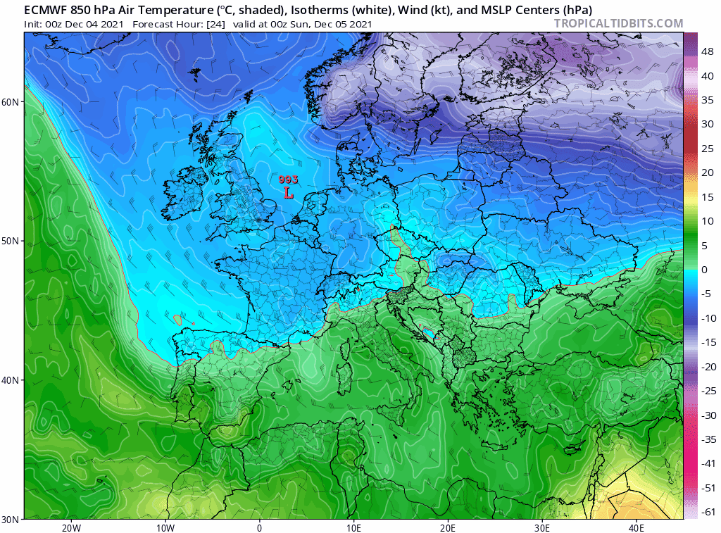
We analyze the likely synoptic evolution for the week 49 from Monday 6 to Sunday, December 12, 2021, using the two main weather and climate models freely available on the network: the European model ECMWF, the American GFS.
The two main global weather models are once again substantially in agreement regarding the synoptic evolution of the coming week. In particular, the most evident novelty is represented by the strengthening of the Atlantic zonal flow that from mid-week will begin to convey a flow of very active disturbances over Northern Europe.
This is due to the gradual dismantling of the Rossby wave that has affected with its main cable the meteorological weather of these last weeks. The main driver of this substantial change in the European synoptic dynamics will be triggered by an intense Atlantic cyclone that will transit over the British Isles heading towards the western Mediterranean from Wednesday.
The intense energy associated with this deep low pressure area with ground level values at its core around 950 hPa, can be guessed from the image below where the vorticity gradients map is shown. These describe how the atmospheric flows (in this case at 850 hPa, about 1400 m) deform and tend to rotate.

The intense Atlantic cyclone arriving over Europe in the second part of the week. ECMWF vorticity gradient maps
The intense Atlantic cyclone will be the harbinger of severe weather and storms particularly over Ireland, but will then tend to rapidly fill in as it descends in latitude, arriving over the Mediterranean as an ordinary low pressure area associated with a typical intense winter-like weather worsening with a series of disturbance fronts.
The vorticity in the Atlantic associated with the cyclone, however, will be the likely trigger of a clear change of general circulation that could lead in perspective to a return of the Azores dynamic anticyclone with the Atlantic disturbances destined to invest only in Northern Europe.
The powerful "cyclonic spin" (pass me the euphemism) that will turn counterclockwise over Western Europe, will basically dismantle the main cable of the Rossby wave, leaving room for the expansion of the Azores anticyclone eastward while waiting for a general reorganization of the pressure fields.
Wind fields, cyclonic vorticity and geopetential height at 850 hPa compared with the pressure fields at ground level and at 500 hPa for the next week, according to ECMWF model.
PRECIPITATON
After the moderate worsening of Sunday, December 5, the circulation from the north will bring a couple of days without precipitation on the macro region Alpeadria. The intense Atlantic cyclone will push towards the Alps and northern Italy first, and then further south in the Mediterranean, a series of fronts.
The first will begin to affect the northwest of Italy on Wednesday, December 8. In the following days our areas will find themselves above the main wind streams and the potential accumulations in several areas will exceed 100 mm as shown below by the map of cumulative rainfall from 5 to 12 December.
This will be a particularly interesting phase, with widespread snowfall from softening on the plains of northern Italy, especially on 8 and 9 December, and of which I speak in more detail in the last paragraph.

Total cumulative precipitation from December 4 to 12 according to the global model GFS. On the Alps possible amounts between 80 and 150 mm, 80% of which will occur in the second part of the week.
TEMPERATURE
The synoptic configuration discussed above is not a harbinger of cold waves in the plains, but rather of temperatures close to those typical of the first decade of December or slightly lower (1-2 ° C) with phases of moderate cold associated with breaks between a disturbance front and the other.
On clear nights and in the early morning there will be widespread frost with temperatures below zero almost everywhere except in coastal areas. Mild temperatures during the day, in line with the climatology or slightly lower.

Anomaly of temperatures at 2 meters above ground on Tuesday, December 7 at 6 UTC (7 local). The conspicuous temperature anomaly in the Eastern Alps will be due to the feedbacks from the snowpack on the ground and the low temperatures at altitude.
Moderate and sometimes intense cold conditions in the whole Alpine area, due to the snow cover on the ground that will increase the albedo and the night radiation, leading to very low temperatures at night. Persistent frost conditions (daily maximum temperatures below 0°C) generally above 1000 m altitude and in the inner valleys.
Starting from the 8th of December, there will be no more conditions for sub-zero temperatures in the lowlands with reduced daily temperature range due to frequent precipitations.
ECMWF animation of temperature and wind fields at the geopotential altitude of 850 hPa (about 1400 m) between Sunday, December 5 and Sunday, December 12.
SNOW
As described above, the first disturbed front will start to affect the northwest of Italy on December 8 with snowfall probably up to the lowlands. Moderate intensity softening snowfall could occur over cities like Turin, Milan and Brescia.
The cushion of cold air accumulated in the early days of the week, associated with the geopotential and temperature values at high altitude, should be enough to ensure the flakes up to the plane. Very unlikely to snow on the plains instead in eastern Veneto and Friuli Venezia Giulia where typically the cold air cushion is quickly eroded by the southern winds strengthening from the Adriatic associated with the arrival of the warm front of the disturbance.
A short initial snowfall on the Friuli Venezia Giulia plain is more possible in these cases on the Pordenone area but in general this is not the favorable situation to have snow on our flat area.

GFS map of the expected precipitation on 8 December. The blue color indicates the snowfall, the green color the rainfall. Evident snowfall from softening on the central-western Po Valley, while the erosion of the cold cushion by the southern winds of recall of the warm front will bring only rain on the plains in the central-eastern area.
The trajectory of the of the front and the synoptic and previous characteristics, would seem to be favorable to intense snowfall on the whole mountain area of the macro-region Alpeadria up to very low altitudes, at least in the initial phase.
Today there are the premises to of intense snowfall in the alpine valleys of Friuli Venezia Giulia, Slovenia and Carinthia with accumulations between 50 and 100 cm in the valley.

GFS chart of the total accumulated snowfall during the week. 10-20 cm possible on the western plains and totals above 100 cm on the mountain areas of Alpeadria.
As said several times, a trend line needs confirmation that we invite to deepen following the update of the agencies in charge as well as the local weather alert services.
What has just been described represents in fact a simple look at the synoptic trend based on the model products freely available on the net, and does not constitute a weather forecast.
For the day by day weather forecasts for the Alpeadria region, please refer to the weather bulletins provided by the official weather services osmer, zamg and arso.
The charts reported and discussed in this article are taken from the portal tropicaltidbits.com. To consult the model updates we suggest to connect directly to the mentioned portal.